Friday evening storms started a small fire, knocked power out in several locations around Monongalia County and caused flooding.
A tree fell on power lines on Dorsey Avenue causing a small fire. The Morgantown Fire Department controlled the fire until the power was shut off and then put it out without issue, according to Station One Duty Officer Gary Freshour.
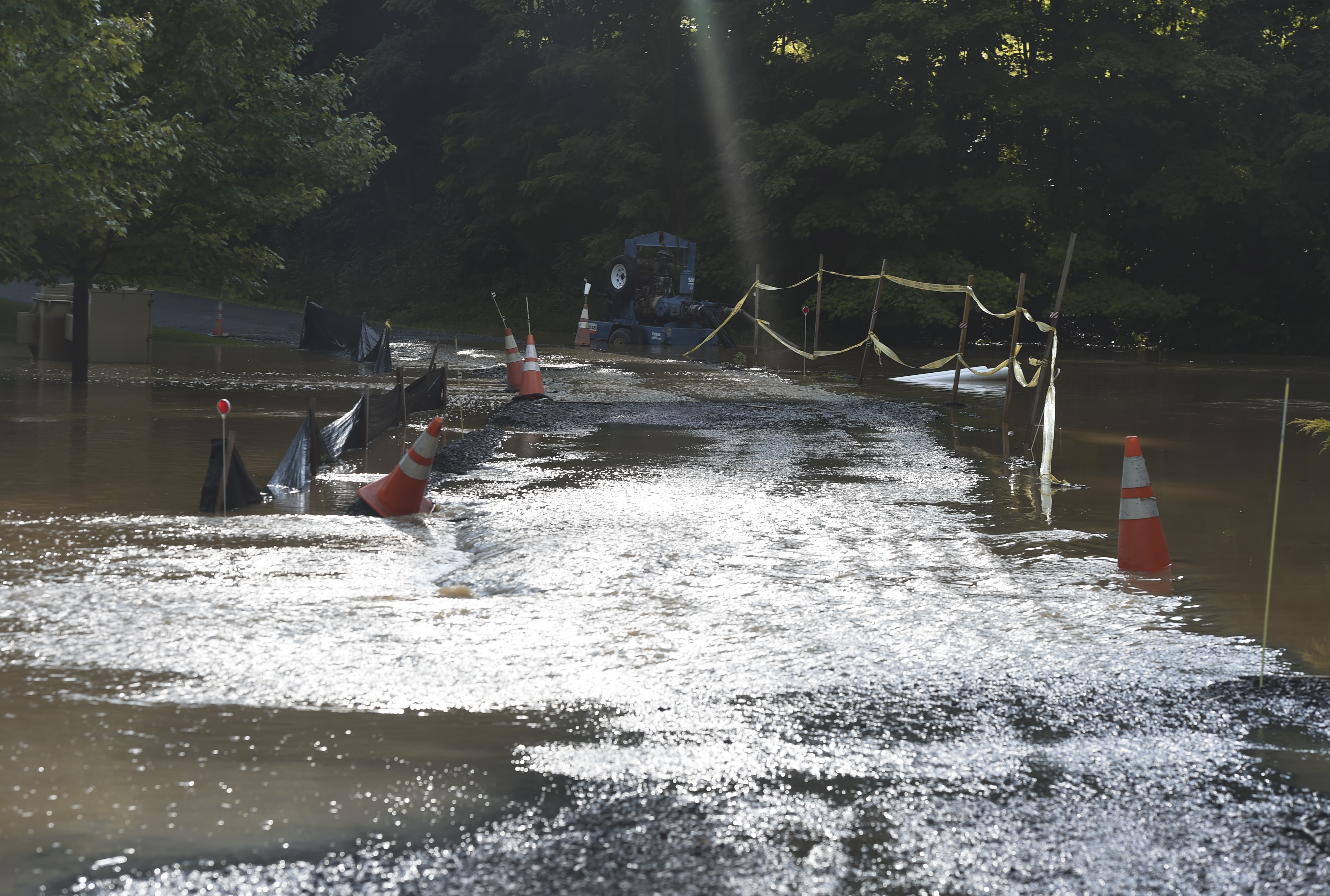
The National Weather Service in Pittsburgh issued an urban and small stream flood advisory for parts of Monongalia County at 5:25 p.m. until 8:30 p.m. Morgantown, Westover, Brookhaven and Cheat Lake would experience flooding, the weather service said.
A flash flood watch was also issued for Monongalia, Preston and several other West Virginia counties until 10 p.m. Friday. In flash flooding situations, anyone who sees more than six inches of water on a road or bridge, or at least three feet of standing water that poses a threat to life or property, should report it to the NWS. Reporting can be done on Twitter or Facebook.
Morgantown received 1.68 inches of rain as of 7:30 p.m. Friday, according to AccuWeather Meteorologist Danielle Knittle. She said, based on the available moisture in the storms, it was predicted 1-2 inches would fall.
Flooding was reported on Stewart Street, in front of Shorty Anderson’s, but when firefighters got there it was no longer flooded, according to a MECCA 911 supervisor. The 911 agency received a report of flooding on Morgan’s Run Road. A home in Greystone also had about two inches of water inside.
According to Mon Power’s website, about 300 customers were affected by multiple outages.
Mon Power’s map also showed outages on Stewartstown Road, Fairchance Road, Kingwood Pike, Mileground Road near the airport and Earl L. Core Road.
The map indicated the outages would be fixed between 7:30 and 9:30 p.m. By 8:45 p.m. only the Earl L. Core Road outage remained.
Morgantown’s Waterfront on Don Knotts Boulevard also experienced a power outage. According to emergency responder traffic, that included traffic lights. The lights and power were restored around 6 p.m.
“Certainly the heavier downpours are on the table again to start off the weekend,” Knittle said.
Scattered showers are expected throughout Saturday, with the biggest chance of heavy rains later in the day. A cold front is moving in from the north and should pass through the area Saturday night, Knittle said.
Sunday will be drier than Saturday but there’s a small chance of continued rain, Knittle said. Both days will have a high of 85 with overnight lows of 69 on Saturday and 68 on Sunday.
TWITTER @WillDean_DP
