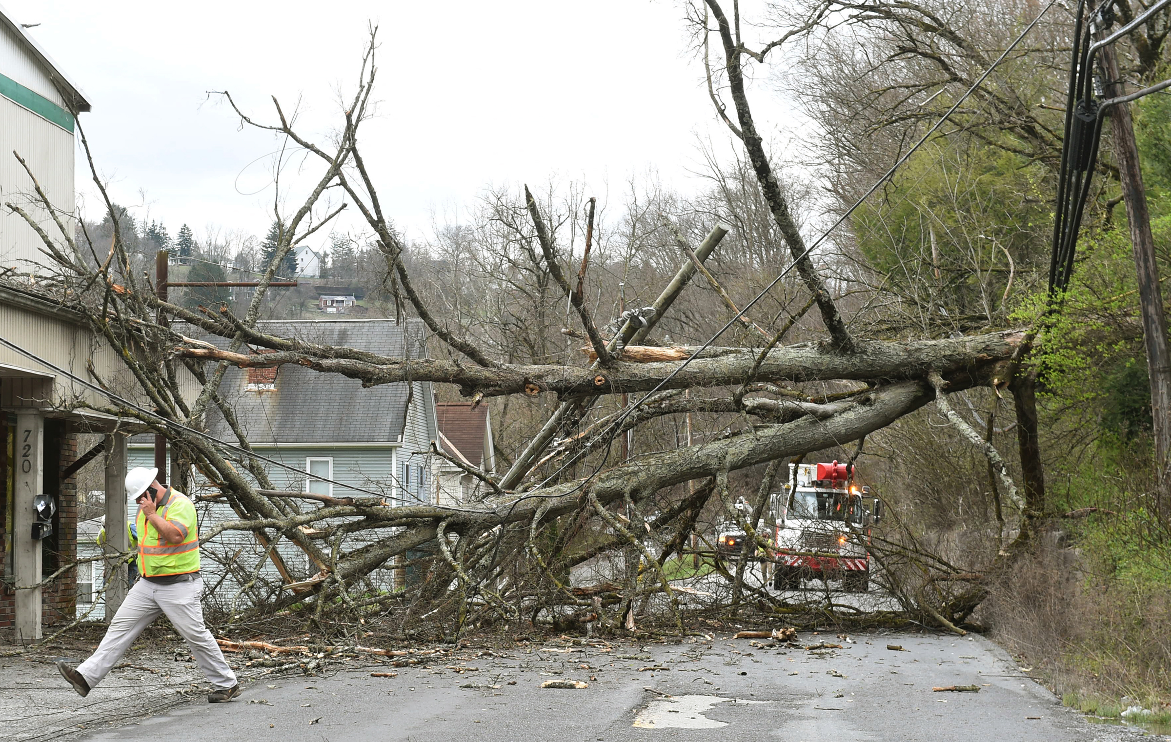
Many area residents were left in the dark Thursday night into Friday after a cold front with strong winds and a sudden temperature change moved through the area causing property damage and power outages across Monongalia and Preston counties.
Will Boye, advanced communications representative at First Energy/Mon Power, said that Friday morning the company had more that 4,000 customers in Monongalia County and more than 200 in Preston County who were without power.
“The storm did cause damage such as downed wires and broken poles across our service area,” Boye said, adding the company had “crews working around the clock to restore power to customers as quickly and safely as possible.”
As of 1 p.m. Friday afternoon, Boye said power to a majority of homes had been restored, but they were still working to get service back to a remaining 678 customers in Monongalia County and 83 in Preston County.
Whenever outages happen, Boye said, customers can visit First Energy’s real-time outage page www.firstenergycorp.com/outages for the most up-to-date information on their outage, including causes, estimated restoration times and crew status, as well as see which areas are still affected by outages.
Bill Modzelewski, meteorologist for the National Weather Service – Pittsburgh, said they tracked wind gusts in the area around 40 to 50 mph in some spots.
“We had an area of low pressure that moved across the area [Thursday] into the evening so we had rain for a good part of the day but had a cold front that came through on the backside of that area of low pressure late [Thursday] evening,” Modzelewski said. “So we had some strong wind gusts and saw our temperature drop when that came through.”
AccuWeather meteorologist Bob Larson said that agency tracked a gust of 55 mph at the Morgantown Municipal Airport just after 8 p.m. Thursday, which was the highest they saw in the area.
However, according to Larson, it is conceivable there were gusts higher than that.
“For whatever reason,” he said, “the observations from the airport stopped right at 9 p.m. Thursday evening and did not resume until 7 a.m. Friday morning. So there is a 10-hour gap with no reports and, unfortunately, it is entirely possible there was a wind gust higher than that within that 10-hour gap, particularly around midnight to 2 a.m. when the actual cold front came though.”
Larson said they are still unsure what caused the device to malfunction at the most critical point of the night, but are assuming it had something to do with the wind.
Their other equipment was taking readings and noted a dramatic temperature drop in the pre-dawn hours Friday.
“It looks as though the cold front came through shortly after midnight around 1 or 2 in the morning and until then it was still above 60 degrees,” Larson said. “By Friday morning at 7 a.m. it had dropped to 28 degrees.”
While Modzelewski and Larson may not agree on the biggest wind gust of the night, the two do have similar predictions for the weekend.
“We are looking at a cold start to this weekend but not cold the entire three-day weekend,” Larson said. “Saturday’s high is around 32, but it will be windy so the real-feel temperature will be in the teens or low 20s.”
“We do have another band of snow showers that should be moving through Saturday morning with another cold front,” Modzelewski predicted. “Accumulation should be less than 1 inch and should taper off through the day.”
Sunday should bring a little warmth and sun back with highs in the mid 40s or upwards of 50 degrees, both Modzelewski and Larson said.
“The warm up continues Monday, Presidents Day,” Larson added. “Sunshine will probably give way to clouds but it will be warmer, it could be as high as 60 degrees.”
